
Benton Neighbors by Public Source
A block lookup starts with geography, not a list of people. Benton County GIS shows parcel shapes and adjacent geometry. PropertyAccess adds a parcel card with owner, mailing address, situs address, sales, value, and sketch information. Recorded plats and deeds explain lot and subdivision ties. Voter records and community groups have stricter access limits and cannot fill every household gap.
| Source | What It Shows About a Block | Access |
|---|---|---|
| Benton GIS parcel map | Boundaries, adjacent geometry, owner, situs, legal and value fields | Public map and query |
| PropertyAccess | Owner, mailing and situs addresses, sales, value and sketch | Public parcel pages |
| Auditor plats and deeds | Lot, block, subdivision, easement and title parties | Index and copy rules |
| Washington voter file | Lawfully public registration and district fields | Controlled SOS extract |
| Richland C.A.P. groups | Police-district community communication | Closed groups; request access |
| Libraries and historical society | Historic clubs, photographs and newsletters | Catalog, appointment or request |
Ownership and occupancy are different facts. An owner may live elsewhere, and a tax-mail destination may be an accountant, trust, or second address. Renters and other household members do not appear as parcel fields. Record OWNER_NAME, OWNER_ADDR, and SITUS_ADDR separately, then describe only what each official field actually proves.
Read Benton Neighbor Parcels
The Benton County parcel layer exposes fields for owner name, owner mailing address, situs address, legal description, value, year built, and sketch or image links. Start with the target parcel, then click at least three parcels that touch it. Roads, alleys, water, rail lines, and public tracts can interrupt what looks like one block on a street map.
The official parcel service shown below provides the map data behind that neighbor context.
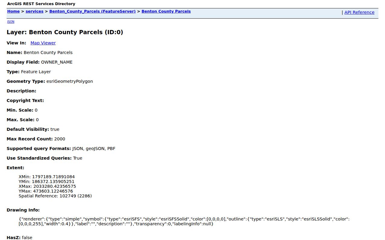
A parcel polygon establishes land geometry, not a household roster. Save the parcel ID and legal description so later searches refer to the same land even if an address changes.
Open the matching card in Benton County PropertyAccess after the map identifies a parcel. The card may add sales history, assessed values, building year, and sketch or image links. These fields help confirm that two similarly shaped lots are not being confused. Compare the parcel number in both systems. Then note whether OWNER_ADDR matches SITUS_ADDR. A match may support owner occupancy, but it still does not identify every person at the address. A mismatch can simply mean tax notices go somewhere else.
Map a Benton Neighbors Block
Use a small, repeatable radius. Benton County's Web Maps page and ArcGIS Hub provide the geographic entry points, while PropertyAccess supplies the official parcel card. Keep the search to the immediate block unless a broader street study is genuinely needed.
- Locate the known address in Benton GIS and confirm its parcel outline.
- Click each touching parcel and record its ID, owner, situs address, and legal description.
- Open the matching PropertyAccess cards and compare mailing with situs addresses without assuming occupancy.
- Check the recorded plat when an alley, easement, public parcel, or subdivision line makes the block unclear.
That flow is address → parcel polygon → adjacent parcels → parcel cards → recorded plat. For an entire named road rather than the few homes nearby, switch to the Benton County street directory workflow.
Benton Plats Define the Block
A plat is the recorded drawing that divides land into lots, blocks, streets, and easements. Search the Benton County Auditor's recorded-document system by the subdivision or legal description found on the parcel card. The deed index can identify title parties, while the plat explains the shared geometry around them.
Do not call two parcels neighbors solely because their street numbers are close. A canal, railroad, private road, or unbuilt tract may sit between them. Rural Benton addresses can also use long directional and private-road forms. Preserve every suffix, and fall back to the county's 16-digit parcel number when the address fails.
Benton's parcel number carries township, range, section, map-position, and added-description segments. Leading zeros may be omitted in some Assessor searches. When a rural home lacks a stable street number, the parcel ID and legal description provide the bridge from GIS to a recorded deed or plat. Search both the current form and the exact form printed on the source. This is especially important for short plats with a temporary “T” address and for land that remained vacant when the county issued surrounding addresses.
Note: Vacant Benton County parcels may have no address, and temporary “T” addresses can change after a residential building permit.
Benton Neighbor Voter Boundaries
Washington MyVote is designed for a person to confirm their own registration with name, birth date, and identity prompts. It is not a public neighbor search box. Statewide database reports, including voter lists and voting-history reports, route through the Secretary of State rather than an informal county request.
RCW 29A.08.720 makes public voter lists subject to exceptions and actual reproduction costs. RCW 29A.08.740 penalizes prohibited misuse, and RCW 42.56.070(8) bars commercial individual lists. Washington's Address Confidentiality Program and protected-voter process keep actual addresses and identifying location fields from ordinary release. A missing voter entry never proves a nearby home is empty.
Richland Neighbors and Civic Groups
Richland Police C.A.P. groups divide community communication among Police Districts 1, 2, and 3. The groups are closed, and residents request access to the group serving them. They are a way to engage with local safety topics, not an open member roster. Richland boards, commissions, City Council meetings, and Clerk records can show public civic participation without exposing private membership.
Richland C.A.P.
Police-district communication through closed resident groups. Request access for the correct district; no public roster was found.
West Richland planning
Comprehensive-plan maps provide neighborhood and land-use context, not a directory of residents.
Badger Mountain South
Planning rules refer to HOA or business-owner associations and CC&Rs. Membership files remain private.
No official countywide HOA or neighborhood-association directory surfaced in the research. Use recorded covenants, plats, city planning records, and a group's own access process. Do not request or publish a private roster.
Public meetings offer a different community trail. Richland Council agendas, boards and commissions, and City Clerk records may name speakers or appointees who chose to participate in civic business. West Richland comprehensive-plan material identifies neighborhood and land-use areas without naming households. Badger Mountain South regulations refer to homeowners' or business owners' associations and recorded CC&Rs, meaning covenants, conditions, and restrictions. Those documents can define the development and its governance, but they do not turn association membership into a public neighbors list.
Historic Benton County Neighbors
Current parcel cards cannot explain every older block. Richland, Hanford, and White Bluffs changed sharply after the 1943 Hanford site selection. The Richland Heritage collection includes photographs and documents that can reveal a building, sign, street form, or neighborhood at a point in time. East Benton County Historical Society materials add images of Kennewick, Richland, Finley, Hover, Hanford, and White Bluffs.
Pair a dated image caption with a directory address, newspaper notice, current parcel, and Auditor deed. The photo can prove place and era, but it cannot identify every person shown. Richland Public Library and Mid-Columbia Libraries can also help locate newspapers, yearbooks, and local-history files when no online name index exists.
Richland Public Library provides access to Richland Heritage, newspaper resources, HeritageQuest, and Ancestry Library Edition in the library. Mid-Columbia Libraries serves Kennewick, Keewaydin Park, Prosser, and West Richland, and staff can help locate print or microfilm years that are not searchable online. Ask for a specific street, subdivision, organization, or date range. The East Benton County Historical Society can add photographs and local pioneer material by an in-person research request. None of these collections should be described as a current roster of Benton County neighbors.
Benton Neighbor Source Comparison
Official records and commercial neighbor tools serve different roles. County and state sources identify the custodian, field meaning, and correction path. Commercial compilations may merge marketing, property, and address-history data, but can be stale or conflate people with similar names. No commercial category result should override a Benton source record.
| Source type | Best use | Main limit |
|---|---|---|
| County GIS and Assessor | Parcel geometry and recorded ownership | Does not list all occupants |
| Auditor plat or deed | Subdivision and title evidence | Index or image access varies by date |
| Community group | Local communication | Closed or private membership |
| Commercial compilation | Unverified lead only | May be old, merged, or unclear |
Correct parcel errors with the Assessor and recorded-document issues with the Auditor. Keep the record date because owners, boundaries, and public access can change.
Benton Neighbors Privacy Limits
Renters, minor children, guests, and other household members do not appear merely because a parcel is public. Utility customers, USPS delivery data, unlisted phone records, DMV addresses, confidential complaints, and sealed court or vital files remain outside a neighbor lookup. A public owner name does not grant access to a private HOA roster or closed community group.
The Washington Address Confidentiality Program provides eligible survivors and other protected people a substitute mailing address. Program records and actual addresses are not public except through lawful exceptions. Never combine parcel, voter, court, or marriage clues to uncover a protected location.
Lawful use. Research Benton County neighbors for lawful civic, family, property, or personal-safety reasons. Never use public records to watch, threaten, stalk, harass, or intimidate anyone.