
Benton Previous Residents by Era
Choose the source that fits the date and the question. The current parcel card is a starting point, not an answer for every year. Deeds supply the legal owner chain. Printed directories and public census schedules add household context, while permits and photographs help date changes to the place. Exact reverse-directory and Sanborn sheet years for Benton County were not verified, so those sources require a catalog check.
| Source | Years covered | Where held | Evidence supplied |
|---|---|---|---|
| Auditor deed indexes | 1906 onward; online around 1971/1972 | Auditor, EagleWeb, PDFs, cash books | Owners, parties, transfer dates, legal land |
| Benton directories | 1911–1918; 1952–1957; 1959; 1961–1965; 1967–1973 | Washington State Library | Names, occupations, spouses, addresses by volume |
| Indexed Polk series | 1911–1916 | Washington Digital Archives | Benton-area name and address clues |
| Federal census schedules | Public after the 72-year release period | Archives and library databases | Household members and place at census date |
| Permits and photographs | Coverage varies | County, city, Richland Heritage | Building work, streetscape, signs, and dates |
For recent work, start with PropertyAccess and the deed index. For an early twentieth-century address, begin with the Polk index or a known deed, then pair it with a public census year. A gap in a directory run is real. Move to newspapers, deeds, photographs, or yearbooks instead of assuming a missing volume once existed.
Start Benton Address History Today
Benton County PropertyAccess supplies the present anchor. Record the owner name, mailing address, situs address, parcel or Geo ID, legal description, lot size or acreage, year built, sales history, and any linked document number. Keep the mailing and situs fields apart. Tax mail may go outside Benton County even when the physical parcel stays local.
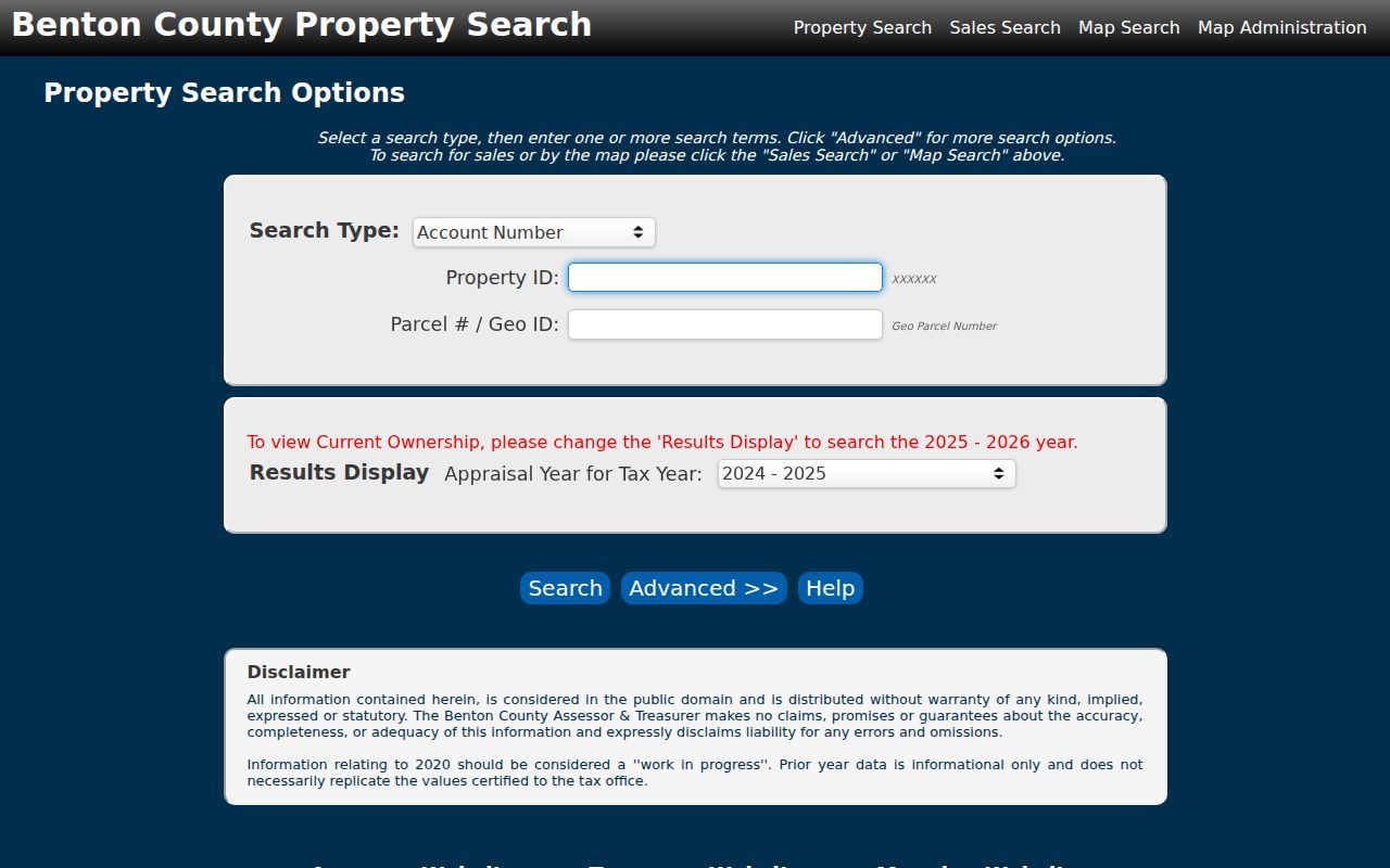
The captured search screen shows the address and parcel routes used to anchor a previous residents timeline. PropertyAccess identifies tax-roll ownership, not all people who occupied the home.
If an address returns nothing, try the Geo ID or legal description from another record. Benton County parcels may be vacant and have no address, or an address may have been temporary. Those conditions make the land identifier more stable than the current street label.
Trace Benton County Owners Backward
The owner trail moves from a present parcel card into the Auditor's recorded documents. A grantor gives an interest; a grantee receives it. Once the current purchase deed is found, search the seller as an earlier grantee. Repeat that move while checking the same legal description. Names alone can drift into unrelated parcels.
- Copy the current owner and full legal description from the Benton County parcel card.
- Find that owner's acquisition deed in EagleWeb. Save the recording date, grantor, grantee, instrument number, and book or page.
- Search the grantor as a grantee to locate the prior acquisition. Confirm the land description before adding it.
- At 1971, check EagleWeb and the historical PDFs because county pages describe the cutoff differently.
- Use a fee number in historical cash books to reach a volume or page, then ask Auditor staff for a copy when no image is online.
- Grantor / grantee
- The grantor transfers an interest, and the grantee receives it.
- Chain of title
- The linked series of recorded transfers for the same land.
- Legal description
- The formal land description, often more durable than a street address.
- Criss-cross directory
- A publication arranged by address or phone number, if that feature exists in the volume.
Benton County EagleWeb is the online index path. Public login can expose index data, while image viewing may require a registered account or subscription.
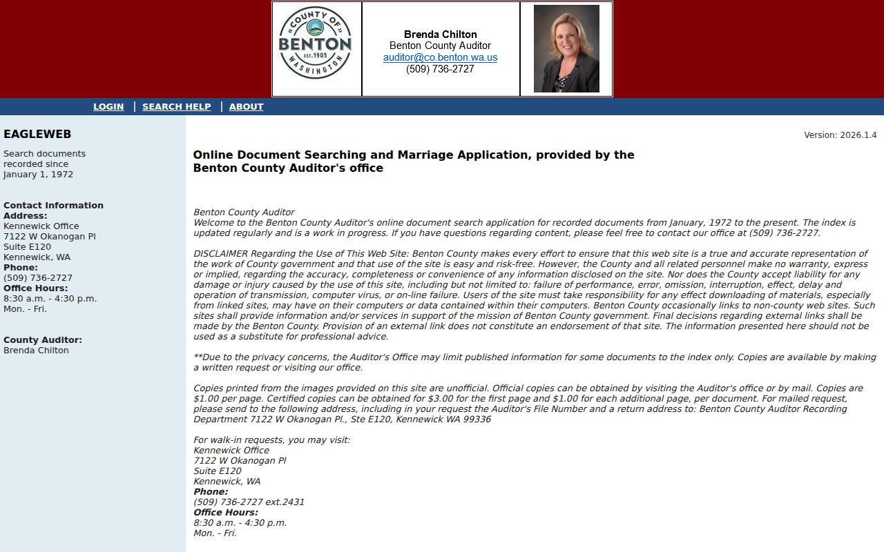
The portal image reinforces the key distinction: finding an indexed instrument does not guarantee that its document image can be viewed online.
Benton's 1971 Record Handoff
The shift from old indexes to EagleWeb is a Benton County story worth slowing down for. The official county page says online coverage begins in January 1971. EagleWeb says January 1972. Historical instructions describe PDF indexes through 1970 or 1971. A search for previous residents tied to a 1971 sale must use all three routes before declaring the document missing.
Historical cash and fee books offer another path. A fee number can reveal the volume, book, page, document type, filer, and date even when a modern keyword search fails. The Auditor's search request form accepts a title, date range, grantor, grantee, and legal description. Requests can go by mail, email, or in person. The county says most are completed within 24 hours and within five working days. Current search and copy fees follow the Auditor's published schedule.
Pair Benton Directories and Census
Ownership is only one part of a home timeline. A directory may list a person, spouse notation, occupation, employer, and residence address. A public federal census schedule can show a household at the census date. Each is a snapshot, not permanent proof. Use the printed abbreviation key, and never assume that “r,” “h,” or “wid” meant the same thing in every volume.
- Find the exact name and address in one verified directory year.
- Record every initial, spouse, occupation, employer, street number, and printed abbreviation.
- Search the next surviving year, noting moves, renumbering, and gaps.
- Compare the nearest public census schedule and its place or enumeration area.
- Return to deeds, newspapers, and obituaries to explain changes between snapshots.
The 1911–1916 R.L. Polk collection in Washington Digital Archives contains 33,453 indexed records from Benton, Franklin, and Klickitat Counties. Search fields include last, first, middle, and Soundex. Soundex can catch similar surname spellings, but the source image should still be checked because the index is volunteer transcribed.
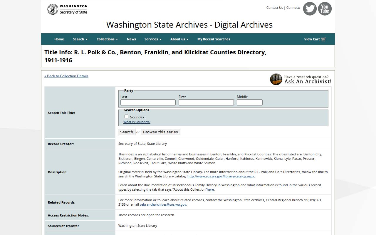
The collection page shows the searchable historic series. More detail on the volume runs and entry format appears in the Benton County city directory.
Keep Benton Addresses Continuous
Benton County's E911 rules allow temporary addresses marked “T” that may change after a residential building permit. Vacant parcels may have none. Private-road forms and quadrant suffixes must be preserved in full. If the street label changes, bridge old and new records with the parcel ID, legal description, plat, and permit file.
Historical place names widen the search. Hanford, White Bluffs, Richland, Horn Rapids, Hover, Finley, Kiona, and precinct labels can appear in directories and newspapers. The federal selection of the Hanford site in 1943 altered communities and the address landscape. A present Richland label should not be projected backward without evidence.
Benton Records Before Countyhood
Benton County was created on March 8, 1905, from Yakima and Klickitat Counties. Its historical recorded-document indexes begin in 1906. A deed, probate file, marriage clue, or census entry from before the county boundary may sit under a predecessor county rather than Benton.
Search the earlier county using the exact settlement and legal land description. Then mark 1905 as a jurisdiction change in the house timeline. That method is safer than treating the lack of an early Benton result as proof that no record existed.
Date Benton Homes and Streets
Permits can record the site, applicant, project type, inspections, and status. Benton County and its cities keep separate records based on jurisdiction. Richland building records may also include plans whose reproduction is limited by copyright. A named applicant is not automatically a resident, but a permit date can explain a rebuilt structure or changed address.
Richland Heritage preserves digitized local material, including Robley “Ron” Johnson photographs of Richland businesses and buildings from the 1950s. Match a caption, sign, or road feature to a directory, newspaper date, current parcel, and deed. The photograph can place a building in an era without identifying every person shown.
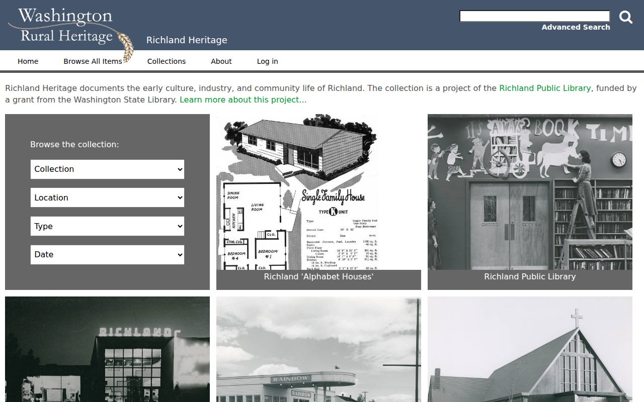
The digital collection provides streetscape context, while physical originals and rights information remain with Richland Public Library.
Benton Maps Need Catalog Checks
Sanborn fire-insurance maps can show building footprints, materials, and street layouts. Washington State Library identifies Sanborn maps among its genealogy resources, but exact Benton County sheet and edition years were not verified. The Library also closed ordinary public access in 2025 and noted limited Thursday appointments, so confirm access or remote help before planning a visit.
The Library of Congress Sanborn collection is a second catalog path, not proof that a map exists for a specific Benton address. Search the town and date, then cite the actual sheet used. A map can help date the building form; it generally does not name previous residents.
Confirm Benton County Past Households
Obituaries and newspapers may connect a death, spouse, business, church, or former street to the household timeline. Richland Public Library offers NewsBank and genealogy resources, with some tools limited to cardholders or in-library use. Mid-Columbia Libraries provides a historic newspaper database with high-resolution PDFs. Search a full name, initials, spouse, street, and alternate city label.
Probate is a Superior Court case type. A public docket may point to a petition, notice, order, personal representative, or heir, but access depends on sealing and court rules. Search the party or case, then request the official file from the Benton County Clerk. Do not infer an heir's residence from a docket name. No countywide official cemetery or funeral-home index was verified, so the library newspaper trail is the sound fallback for previous residents.
Lawful use. Research Benton County previous residents for house or family history. Never use a record to harass, track, or harm a living person.